1/5


Hiking Slovakia - Tourist Map
1K+ดาวน์โหลด
31MBขนาด
3.0.10(26-03-2022)เวอร์ชั่นล่าสุด

รายละเอียดรีวิวเวอร์ชั่นข้อมูล
1/5
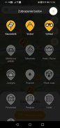
คำอธิบายของHiking Slovakia - Tourist Map
แอพเดินป่าครอบคลุมพื้นที่สโลวาเกีย ที่นักปีนเขาทุกคนต้องมี
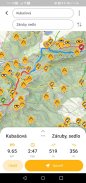
• เส้นทางเดินป่าและทางแยกที่ทำเครื่องหมายไว้ทั้งหมด
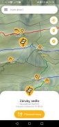
• วางแผนเส้นทางพร้อมโปรไฟล์ระดับความสูงและกำหนดการเดินทาง
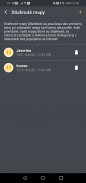
• ฐานข้อมูลขนาดใหญ่ของยอดเขา จุดชมวิว สถานที่ปิกนิกหรือตั้งแคมป์ ปราสาท ถ้ำ แหล่งน้ำ ที่พักพิง หรือที่พัก
• แผนที่ระดับความสูงและเส้นขอบพร้อมมาตราส่วน
• ความสามารถในการดาวน์โหลดแผนที่ไปยังโทรศัพท์และใช้งานแบบออฟไลน์
• การระบุตำแหน่งปัจจุบัน
• ค้นหาจากป้ายบอกทางและจุดที่น่าสนใจอื่นๆ
• ดูทิวเขาเมื่อซูมออก
• เข็มทิศ
คำเตือน: ถ้าคุณชอบหลงทาง รักอะดรีนาลีนและเอาชีวิตรอด อย่าโหลดแอปนี้... ;-)
แอปพลิเคชันใช้ข้อมูลที่มีให้อย่างอิสระจาก freemap.sk และ openstreetmap.org
Hiking Slovakia - Tourist Map--เวอร์ชั่น3.0.10
(26-03-2022)ข่าวใหม่Fixed missing map tiles on old AndroidsFixed importing POIs and routes on low-memory phones

Hiking Slovakia - Tourist Map - ข้อมูล APK
เวอร์ชั่น APK: 3.0.10แพ็คเกจ: sk.archae.hiking.androidชื่อ: Hiking Slovakia - Tourist Mapขนาด: 31 MBดาวน์โหลด: 32เวอร์ชั่น : 3.0.10วันที่ปล่อย: 2024-05-30 19:20:49หน้าจอขั้นต่ำ: SMALLCPU ที่รองรับ:
ID ของแพคเกจ: sk.archae.hiking.androidลายเซ็น SHA1: 4E:C3:1D:BD:EA:B8:A0:08:D0:C3:F7:C9:84:A4:27:21:E2:DA:1A:8Dนักพัฒนา (CN): องค์กร (O): GeoEmpiresท้องถิ่น (L): Bratislavaประเทศ (C): SKรัฐ/เมือง (ST): ID ของแพคเกจ: sk.archae.hiking.androidลายเซ็น SHA1: 4E:C3:1D:BD:EA:B8:A0:08:D0:C3:F7:C9:84:A4:27:21:E2:DA:1A:8Dนักพัฒนา (CN): องค์กร (O): GeoEmpiresท้องถิ่น (L): Bratislavaประเทศ (C): SKรัฐ/เมือง (ST):
เวอร์ชั่นล่าสุดของHiking Slovakia - Tourist Map
3.0.10
26/3/202232 ดาวน์โหลด16.5 MB ขนาด
เวอร์ชั่นอื่น
3.0.9
26/3/202232 ดาวน์โหลด16.5 MB ขนาด
2.3
27/1/202132 ดาวน์โหลด4.5 MB ขนาด
2.2
14/1/202132 ดาวน์โหลด4.5 MB ขนาด
2.1
21/11/202032 ดาวน์โหลด4.5 MB ขนาด
2.0
17/11/202032 ดาวน์โหลด4.5 MB ขนาด
1.8
3/3/202032 ดาวน์โหลด4.5 MB ขนาด
1.7.4
13/12/202232 ดาวน์โหลด6.5 MB ขนาด
1.6
25/8/201732 ดาวน์โหลด5.5 MB ขนาด


Overmortal 4.83
4.83
4.83


แอปในประเภทเดียวกัน


English


